Systematic conservation planning
Systematic conservation planning links spatial information on habitats, wildlife and human activities with managers, stakeholders and communities using advanced technologies in geographic information systems, remote sensing and artificial intelligence.
Research projects
Current research includes:
- Modelling options for marine conservation in New Zealand
- Monitoring island morphology, vegetation and marine life
- Identifying opportunities and challenges for aquaculture and other blue economies
- Mapping changes in coastal ecosystems from development, forestry, climate change and restoration
Recent research projects included spatially modelling for:
- Marine conservation in New Zealand
- Monitoring the morphology, vegetation and seabirds of coral reef islands
- Mapping marine habitats using unmanned aerial vehicles (drones)
- Spatial planning and information systems for aquaculture and other blue economies
- Mapping changes in ecosystems from development, forestry and climate change
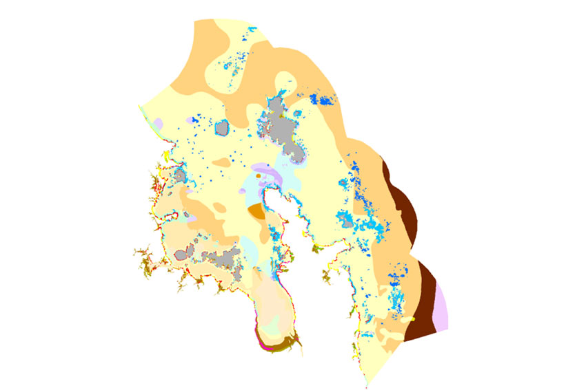
Habitat mapping and marine conservation planning for the Hauraki Gulf Marine Park and New Zealand Territorial Sea. Spatial optimisation techniques are being used to prioritise areas for conservation and sustainable use.
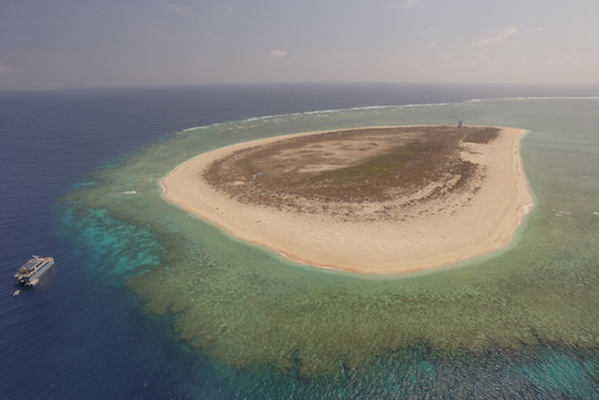
Raine Island is largest green turtle rookery in the world and one of the most important seabird islands on the Great Barrier Reef. As part of a recovery plan for the island, unmanned aerial vehicles (drones) are being used to map changes in island morphology, vegetation and thousands of seabirds.
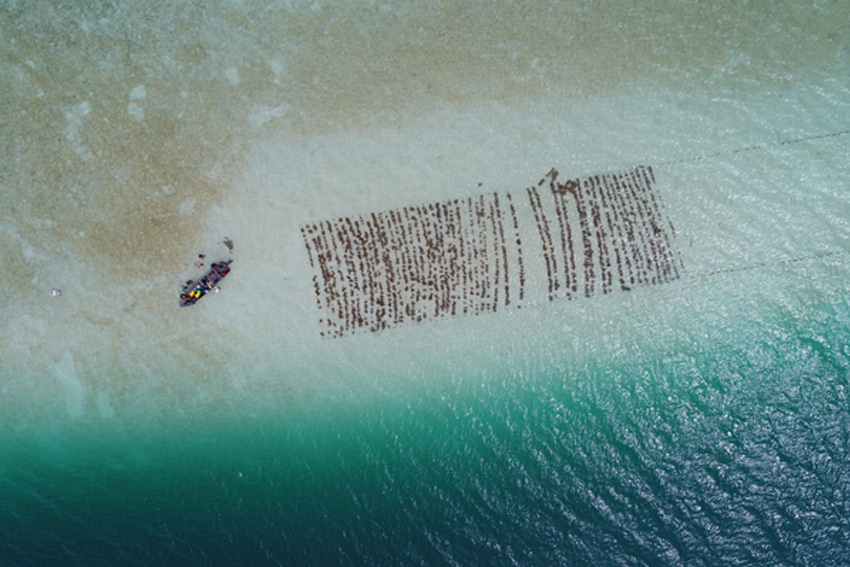
Mapping and spatial planning for seaweed aquaculture (Vona Vona, Solomon Islands). Tropical seaweeds can provide important income for coastal communities. Drone imagery and geographic information systems are being used to map and help plan for seaweed cultivation in the Pacific.
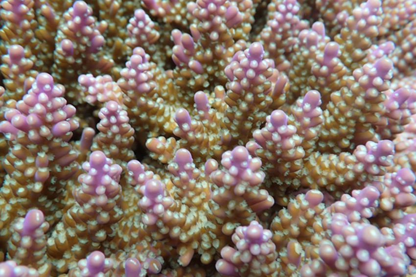
Mapping coral species composition (Acropora secale, Vavanga, Solomon Islands). Spatial analyses of coral and fish assemblages are being used to map fine scale changes in coral reef habitats.
Postgraduate students researching changes in coral and fish assemblages in the Solomon Islands in relation to coastal development and forestry.